Mossdale Landing West Project

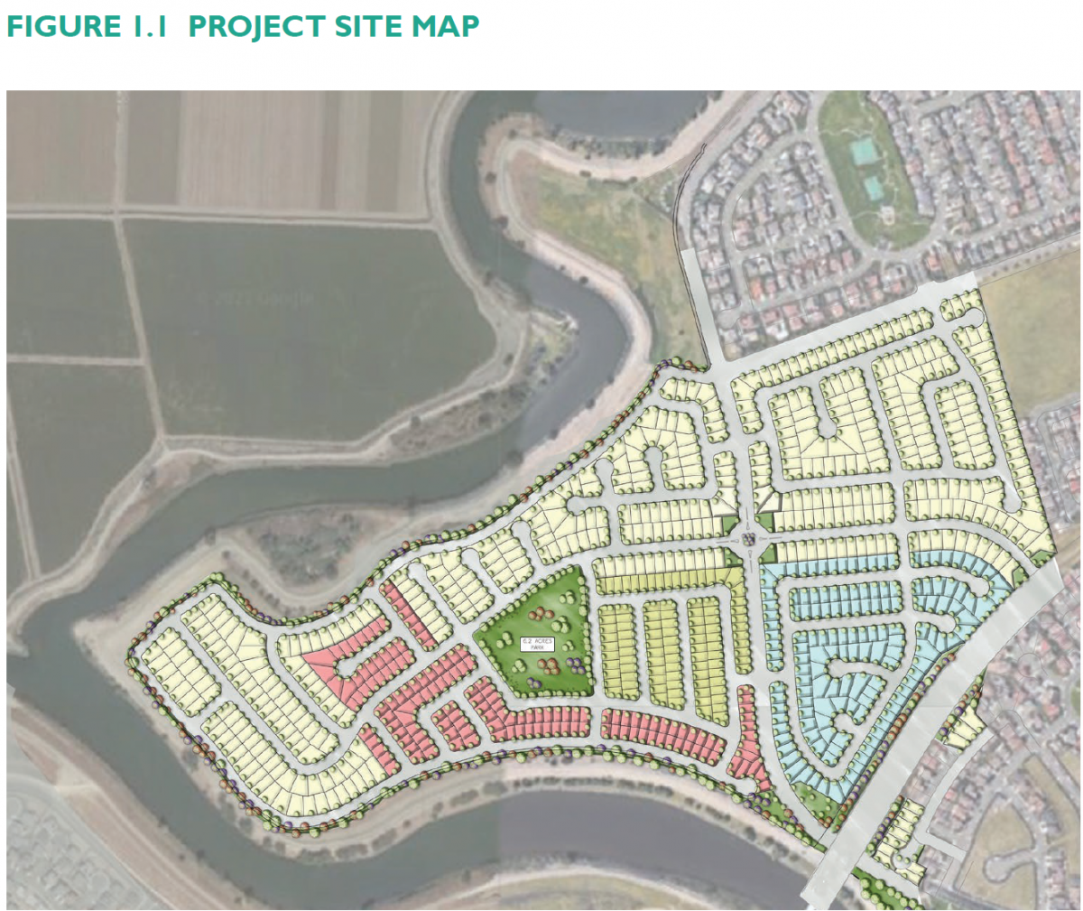
The proposed project is a low-density residential community that includes 829 single-family lots on a 169-acre site. The project will feature a 6.2-acre park near the center of the subdivision and a 5.5-acre linear park along the perimeter of the site adjacent to the San Joaquin River. The linear park will tie into the linear parks already constructed in Mossdale and future connection to Stanford Crossing. The project will include new roads (and will complete the connection between Spartan Way and Towne Centre Drive) which will be designed according to City standards. Various utilities such as sanitary sewer, water, and storm drain systems will be extended to serve the subdivision.
Project Location:
The project site is located within the West Lathrop Specific Plan, bounded by Barbara Terry Boulevard to the north, River Islands Parkway to the south, and San Joaquin River to the west.
Project Files:
- Mossdale Landing West Vesting Tentative Map
- Mossdale Landing West Specific Plan
- Mossdale Landing West Draft Text Amendment
City Council Approval Documents
- City Council Report Mossdale Landing West Project August 11, 2025
- Ordinance 25-469 Approving the Mossdale Landing West Specific Plan
- Ordinance 25-470 Amending the Zoning Map and Zoning Code Text for Mossdale Landing West
- Reso 25-5869 Certifying the Final Environmental Impact Report for Mossdale Landing West
- Reso 25-5870 General Plan Amendment to Land Use Map for Mossdale Landing West
- Reso 25-5871 Vesting Tentative Map 4146 for Mossdale Landing West
- Reso 25-5872 Tentative Approval of Cancellation of Williamson Act 73-C1-73 (AGC-22-28)
CEQA Documents
- Notice of Determination for the Mossdale Landing West Project
- Mossdale Landing West Specific Plan Final Environmental Impact Report with Appendices
- Notice of Availability for the Mossdale Landing West Draft Environmental Impact Report
- Mossdale Landing West Specific Plan Draft Environmental Impact Report with Appendices (Public Review Draft)
- Mossdale Landing West Specific Plan Draft Environmental Impact Report (Public Review Draft)
- Notice of Preparation of an Environmental Impact Report and Scoping Meeting for the Mossdale Landing West Specific Plan
- Notice of Preparation of an Environmental Impact Report and Initial Study for the Mossdale Landing West Specific Plan
